
Article by: Hari Yellina (Orchard Tech)
In recent years, precision agriculture has adopted digital technologies in order to upgrade itself. Moreover, these new methods are helping farmers manage crops and fields in an innovative manner. It is without a sliver of doubt that the newest digital technology has made agriculture more profitable, efficient, safer, and simple. Among other technologies, farmers have picked five they deem to be the best:
There are numerous benefits that technology has contributed to agriculture. These benefits include reduced consumption of water, nutrients, and fertilizer, reduced negative impact on the surrounding ecosystem, reduced chemical runoff into local groundwater and rivers, better efficiency, reduced prices, and many more. Therefore, businesses using this technology become cost-effective, smart, and sustainable.
Since fields are location-based, GIS software becomes an incredibly useful tool in terms of precision farming. While using GIS software, farmers are able to map current and future changes in precipitation, temperature, crop yields, plant health, and so on. It also enables the use of GPS-based applications in line with smart machinery to optimize fertilizer and pesticide application; given that farmers don’t have to treat the entire field, but only deal with certain areas, they are able to achieve conservation of money, effort, and time.
Another great benefit of GIS-based agriculture is the application of satellites and drones to collect valuable data on vegetation, soil conditions, weather, and terrain from a bird’s-eye view. Such data significantly improves the accuracy of decision-making.
Predicting yields, as well as conducting almost real-time field monitoring, with a view to detecting a variety of threats with satellite data in service has never been so easy.
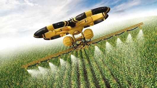
With the assistance of drones farmers have an opportunity to define crop biomass, plant height, the presence of weeds, and water saturation on certain field areas with high precision. They deliver better and more accurate data with higher resolution in comparison to satellites. When they are locally operated, they provide valuable information even faster than scouts. Drones are also considered to be unrivaled aides in the battle against insects; the invasion is prevented by applying the insecticide on the hazard areas using drones, all while reducing the likelihood of direct exposure leading to chemical poisoning.
Despite the fact that drones are easy to use and are capable of collecting large amounts of data within short time frames, there are still challenges when using them on a constant basis as they don’t come cheap. Drones are almost helpless where mapping or monitoring of large areas is required, and it is better to complement the technology with satellite monitoring among already mapped areas, where specific zones need to be cross-checked.