
Article by: Hari Yellina
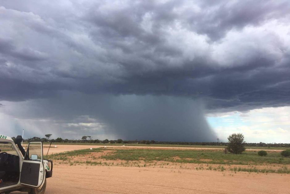
Heavy rain and damaging winds are expected to hit parts of Western Australia starting this evening, as two systems combine to send a blast of wintry weather to half of the state. Rainfall totals of up to 60 mm have already been recorded in portions of the state’s west coast and south-west on Thursday. Perth residents are under a road weather warning. People in sections of the Central West, Gascoyne, and Pilbara have been given a severe weather warning for damaging gusts of up to 90 kilometres per hour and heavy rainfall, which is expected to build from early afternoon near the coast.
According to the Bureau of Meteorology, six hourly totals of 60 to 90 mm are possible, with isolated amounts of 100 to 150 mm possible in the north-west, including Exmouth and Onslow (BOM). A separate warning for severe gusts up to 90 kilometres per hour has been issued for those on the south coast, from Augusta to Hopetoun. Western Australia is getting its first big rain of the season, which will help crops and sun-dried forests in the state’s south-west. Rain is expected to fall throughout half of the state over the next two days, with showers reaching from the West Pilbara to Eucla. Today would be the main event, according to BOM duty forecaster Jessica Lingard.
The majority of the rain will fall on Thursday, with showers diminishing in the South West on Friday but continuing into Saturday in the northern and eastern parts. Between Shark Bay and Israelite Bay, a severe surf of five to eight metres is forecast to kick up from Thursday night into Friday. The tides could possibly be higher than usual. A combination of a cold front and a moisture-laden cloud band extending from an ex-tropical storm, according to Ms Lingard, is causing the rain. “We had those three cold fronts go through in fast succession a few of weeks ago,” she explained, “but they didn’t deliver much rainfall and didn’t push very far inland.”
“So, this is the first large system to pass through agricultural areas in a reasonable amount of time.” It will be a much-needed relief for the region after a searing hot summer that shattered multiple heat records, including the warmest summer on record for Perth. While a wet winter in 2021 protected some deeper-rooted plants, the high heat had taken its toll, according to Joe Fontaine, a Murdoch University lecturer in environmental and conservation sciences. “In portions of the northern jarrah forest, we’ve noticed that sites with a bit less water for plants have started to perish,” he said.
He indicated that while some plants might not survive, others will, and that the next rain would be crucial. “As you can imagine, it’s like running a marathon for these plants every summer,” he explained. “The longer autumn goes without significant rainfall, the more likely those plants will not make it to the finish line.” “A nice season break like this, with 15 to 30 millimetres of rain, is critical.” Farmers in the Great Southern who have already sown their grain crop for the year are also hoping for rain. Autumn rainfall has been uneven across the state thus far.
While rainfall has been slightly above average on the south coast, in sections of the central west, and in Gascoyne, rainfall has been ordinary to below average in Perth, the Great Southern, and the South West. Ed Naisbitt, a grain farmer from Tarin Rock, told the WA Country Hour that they hadn’t got any decent rain in over a month. “The leaves are withered and hanging limp, and moisture stress is visible, so they won’t develop vigorously in those conditions. “Looking at them is likely to make the person anxious. He said they were hoping for another 25mm of rain. Agricultural areas are forecast to get between 10 and 30mm, according to the bureau.